Last Saturday, I gave a 20-minute update on the DRAFT Oregon Wildfire Hazard Map. I presented the good and bad news regarding this notorious map. (Video shown below.)
Good News
The good news is that we can submit written comments in opposition to this map. The deadline is August 18 at 5PM.
That was the extent of the good news.
Bad News
There is a lot of bad news to report.
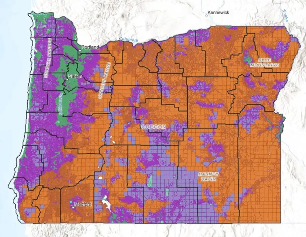
1. This map is not much better than the Oregon Wildfire Risk Map of 2022 created under SB-762. The revised map still appears to have been created by a computer, bot or AI Assistant. There are 3 levels of hazard: low hazard, moderate hazard and high hazard.
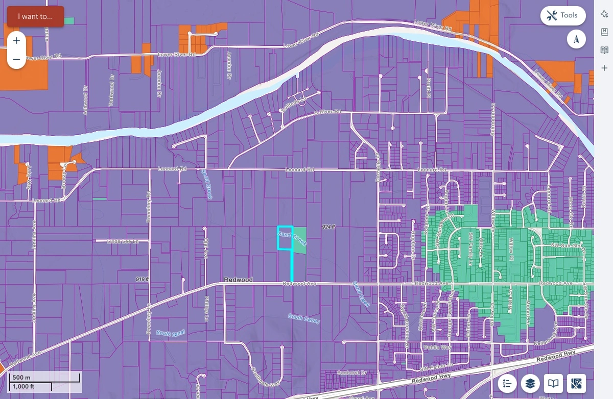
I checked the map for the Redwood area of Grants Pass. One “low-hazard” property is surrounded by “moderate-hazard” properties. Did that person make a large campaign contribution? Or did the AI Assistant hallucinate?
Some riverfront properties are shaded orange because they are “high-hazard.”
Properties designated “High Hazard” and located in the Wildland Urban Interface (WUI) could require fire sprinklers, metal roof and other “hardening” requirements for new home building or major remodels.

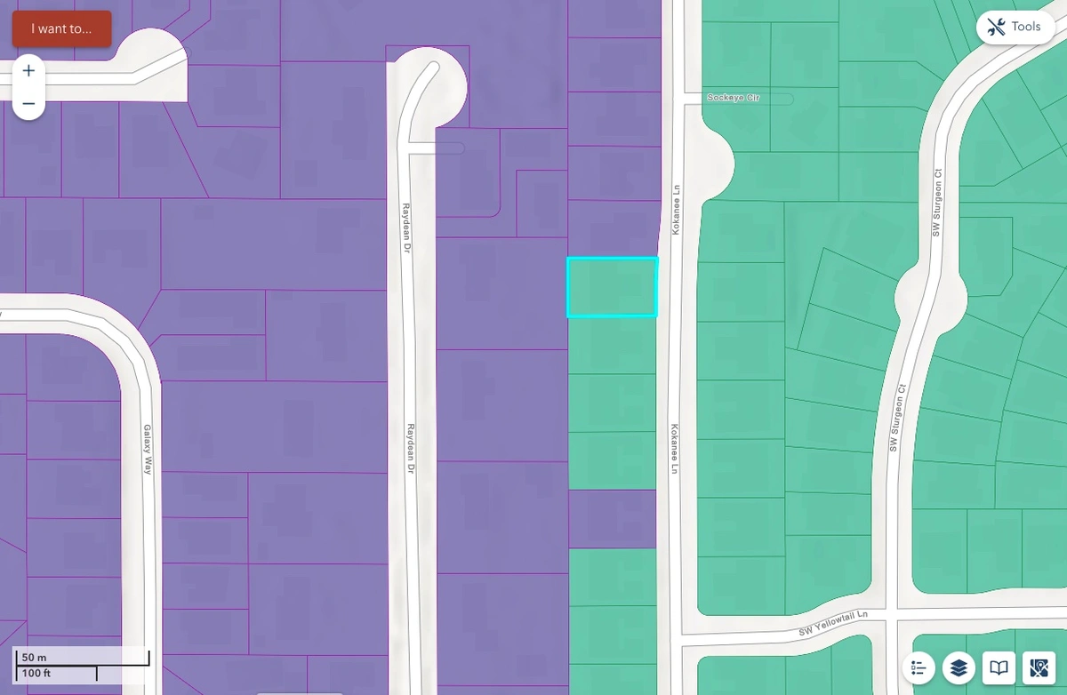
Orange: High hazard properties. Purple: Moderate hazard. Green: Moderate-hazard.
Some residences in the green Low-Hazard area are across the street from other homes which are in the purple Moderate-Hazard area. Does this make sense?

You can search for your property using the State’s interactive mapping program:
https://oregon-explorer.apps.geocortex.com/webviewer/?app=665fe61be984472da6906d7ebc9a190d
2. There was a huge uproar in 2022 because affected homeowners received a letter from the state along with the map. In 2024, the deadline for public comments is August 18. The letters will be mailed out on October 1 which is after the map is finalized. Any map problems would need to be appealed at an unknown cost in time and money.
3. More bad news is that federal timberland of the BLM and U.S. Department of Forestry will not be restricted by SB-762 or SB-80. Yet we all know that most wildfires become wild and out of control because federal land is not managed at all.
4. The existence of this map will affect the buying and selling of rural real estate in Oregon. Technically, insurance companies cannot use this map to set insurance rates. They have their own maps. The reality is that this map creates the perception that most of Oregon can go up in flames at any time.
Eagle subscriber and advertiser Marian Szewc of Windermere attended one of the public comment Zoom calls. She jumped in to make public comment due to the lack of participation. Some people asked questions (wrong), some just ranted about problem without bothering to say “I object to the map because ….” Marian’s summary of her comments included the following:
“I said that this [map] will cause a lot of harm for people being able to afford homeowners’ insurance (someone else mentioned that), so yes this is true, but even more, I said, it will make it almost impossible to sell your home because a new home buyer will not be able to get or afford the new homeowners’ insurance. It’s already happening now and with this map it is going to get a lot worse. (I didn’t even mention that buyers are going to shy away from the area in fear of being burnt to a crisp because based on the map we’re mostly 9/10 risk for “devastation.”)
Don’t get depressed, take action and send in a comment to make your voice heard.
5. A final piece of bad news is that SB-762 will shift the State of Oregon’s forest fire fighting efforts from the General Fund (funded by personal and business income taxes) to property owners in hazard areas.
Eagle subscriber Jeff Sterling passed on this helpful update to me today:
“If you are opposed to the wildfire hazard mapping, please start your comment with “I am opposed to the wildfire hazard mapping because—” then give your reasons why including cost of insurance, property values, ability to buy and sell, etc. There is about 1 and a half weeks left to get comments in.
“There are only 57 comments so far and some have been thrown out because of not clearly stating they are opposed to the wildfire hazard mapping. Please forward to anyone who might be interested…Jeff”
https://www.oregon.gov/odf/board/pages/comments
Unfortunately, the link no longer works.
That only 57 people have bothered to submit a comment means your comment will carry more weight. We need thousands of comments to make a significant difference.
You can view maps and make public comments at the Oregon Department of Forestry website:
Public input on draft wildfire hazard maps encouraged!
Drafts of updated wildfire hazard and wildland-urban interface maps are available for review and public comment. View the draft maps at Oregon State University’s Wildfire Risk Explorer.
ODF will be accepting public comment from July 18 to Aug. 18. When the comment period is complete, ODF and OSU will evaluate all public comment to see whether changes to the maps are warranted.
Public comment can be sent by email to: hazardmap@odf.oregon.gov.
https://www.oregon.gov/odf/fire/Pages/wildfire-hazard.aspx
Richard Emmons Talks About the New “Hazard Map”
Richard Emmons is the publisher and editor of the Oregon Eagle.
