Skip to content
Menu
Home
News
Local
Oregon
USA
Politics
Opinion
Other
Business
Crime & Punishment
Economy
Education
Energy
Faith
Health
Housing
Property Rights
Sports
Taxes
War
Subscribe
Donate
Advertising
Login
Account Portal
Eagle Facebook Group
Contact
Bob Hart
Bob Hart was a county planner for 20 years and has 25 years’ experience as a private planning consultant. An Air Force veteran, he has been a Southern Oregon resident for 44 years and enjoys his hobby of drag racing.
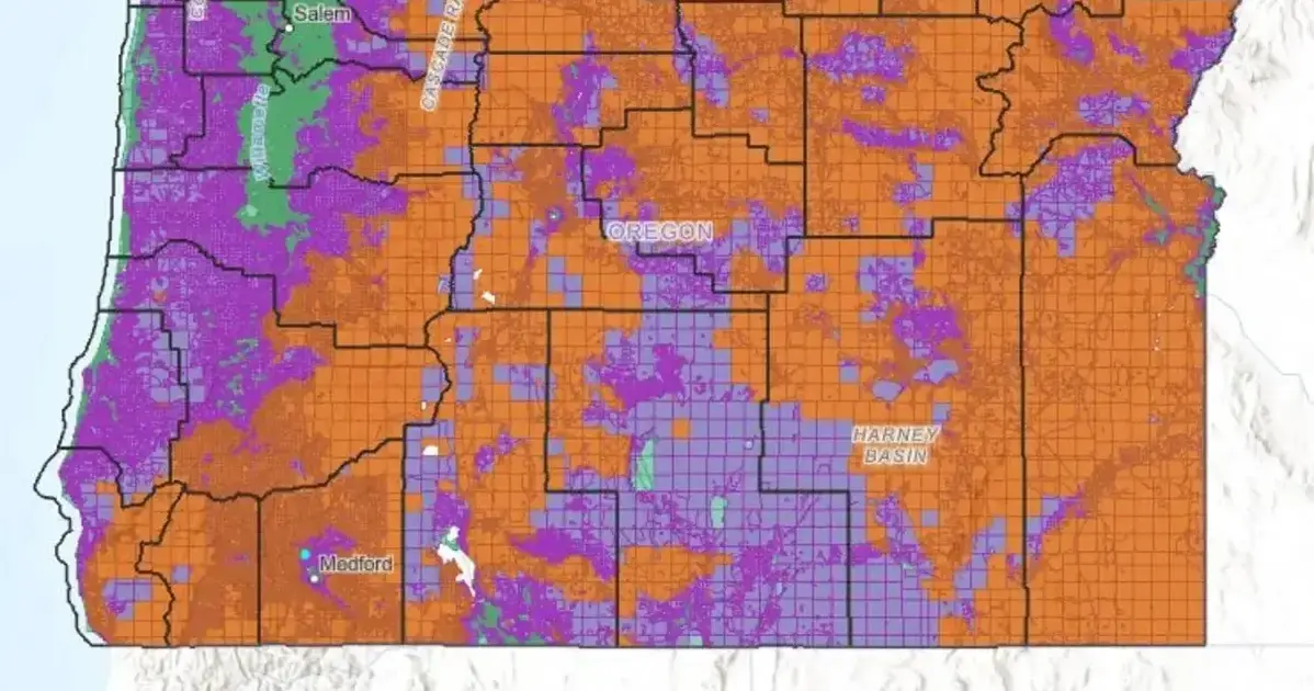
Public Comment Needed NOW on Revised Oregon Wildfire Risk Map
July 31, 2024
by
Bob Hart
…
Read more