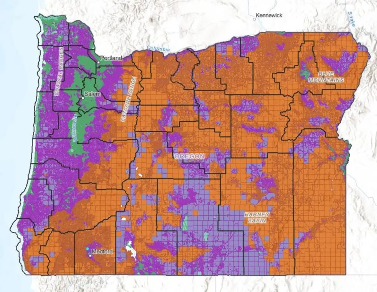
A revised Oregon Wildfire Map was released on July 18. This map is available at the Oregon Explorer website. https://hazardmap.forestry.oregonstate.edu/ Release of this map began a 30 day period to comment on the map.
The revised map changes “Risk Map” to “Hazard Map” and combine the Extreme Risk and High Risk areas into High Hazard. The Low Risk and No Risk areas are being combined into Low Hazard areas so there are now only three categories.
The State has said that lands within the High Hazard and Wildland Urban Interface (WUI) are identified as subject to the mandatory rules on Defensive Space and Home Hardening. The State also has said that properties that have irrigated lands were reviewed and may change Hazard categories as the hazard could reduce fire intensity or probability. The irrigation review must still be adopted by the Board of Forestry at their meeting on September 4, 2024.
Oregon Department of Forestry is conducting three zoom public meetings on the Wildfire Maps rules that include irrigation review as noted above. The zoom meetings are scheduled for today at 10:00 a.m. and 2:00 p.m and Thursday August 1 at 6:00 p.m. The link for information is: https://content.govdelivery.com/accounts/ORFORESTRY/bulletins/3a8430d
Input can also be given during any of the virtual public meetings below:
1. July 31, 10 a.m., Zoom meeting
2. July 31, 2 p.m., Zoom meeting
3. Aug. 1, 6 p.m., Zoom meeting
Written comments can also be sent to maprules@odf.oregon.gov until 5 p.m. on Aug. 15. Please clarify which rule your comments pertain to in your email.
The new rules require appeals to be considered as a Contested Case in accordance with ORS Chapter 183. This process will require that the Hazard assignment be based on error in the calculation and data used by the State to classify your property based on the requirements of OAR 629-045-1026 to include annual burn probability, wildfire intensity using peer reviewed data sets.
The basic four factors include weather, climate, topography and vegetation. Initial conclusions of staff are that appeals will be very limited. No matter what you do to reduce fire hazards, your property will be judged based no solely on your property but also lands within 1.5 miles around your property. (OAR629-044-1005).
At the conclusion of the appeal period, the full law goes into effect. The new law includes mandatory requirements for defensible space on all improved properties and new building codes for Home Hardening of new construction and remodel of existing buildings.
The original Wildfire Risk Laws (SB762) came to the public’s attention when a required letter was mailed to property owners in the Extreme and High Risk areas. There was so much opposition to the new law that the map was withdrawn and new legislation (SB 80) was adopted to “course correct” the laws. A letter is again required to be sent to property owners within the High Hazard areas and the Wildland Urban Interface. However, in the time line established by the state, the letters will be sent on October 1, 2024 AFTER all the review and comment periods are over.
A requirement in the state law is that there is required “robust community engagement through a process that: (a) Ensures, through the use of clear language, graphics, visuals and examples, that the underlying criteria for assigning hazard zones are publicly available and comprehensible to a public audience. (b) Is interactive and does not consist solely of delivering information in a top-down manner.” My opinion is that these requirements are not met.
The upcoming review and comment period and “zoom public hearings” maybe your only chance to have meaningful input on the revised Wildfire laws. Be involved to protect property rights.
Bob Hart was a county planner for 20 years and has 25 years’ experience as a private planning consultant. An Air Force veteran, he has been a Southern Oregon resident for 44 years and enjoys his hobby of drag racing.
